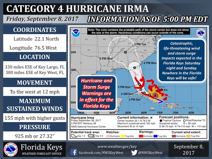
Projection Shows Landfall Coming Sunday Morning At Key Largo Before Heading To Miami

The worst-case scenario seems to be developing for the Florida Keys and South Florida as Hurricane Irma approaches the state.
Irma is projected to hit as a Category 5 storm, with maximum sustained winds of 155 mph. And Irma will bring more than just that big wind – it’s a wet storm and a 6- to 12-foot storm surge is expected, as well.
Most of the Florida Keys are only three to five feet above sea level, so even a six-foot surge will put it under water.
The storm is expected to make landfall at Marathon in the middle Keys and Key Largo in the northern Keys on Sunday morning between 5-7 a.m.
From there, it will head toward Miami – possibly as a Category 4 storm – at around 2 p.m. It will then be downgraded to a tropical storm as it makes its way up the state, reaching Jacksonville Monday afternoon with winds of 60 mph.
Irma was downgraded to a Category 4 after ripping through the Caribbean – causing substantial damage to places such as the British Virgin Islands – but is expected to regain its full strength by the time it arrives in Florida.
The Florida Keys have been evacuated earlier this week and evacuation and low-lying areas of South Florida counties are under an evacuation order.
“We’re going to have a couple rough days,” Brock Long, administrator of the Federal Emergency Management Agency (FEMA), said at a press conference Friday morning.
The National Weather service posted this warning to anyone left in the Keys on its Twitter account (in all caps for extra emphasis):
***THIS IS AS REAL AS IT GETS***
***NOWHERE IN THE FLORIDA KEYS WILL BE SAFE***
***YOU STILL HAVE TIME TO EVACUATE***
Please RT. #Irma
Leave a Reply